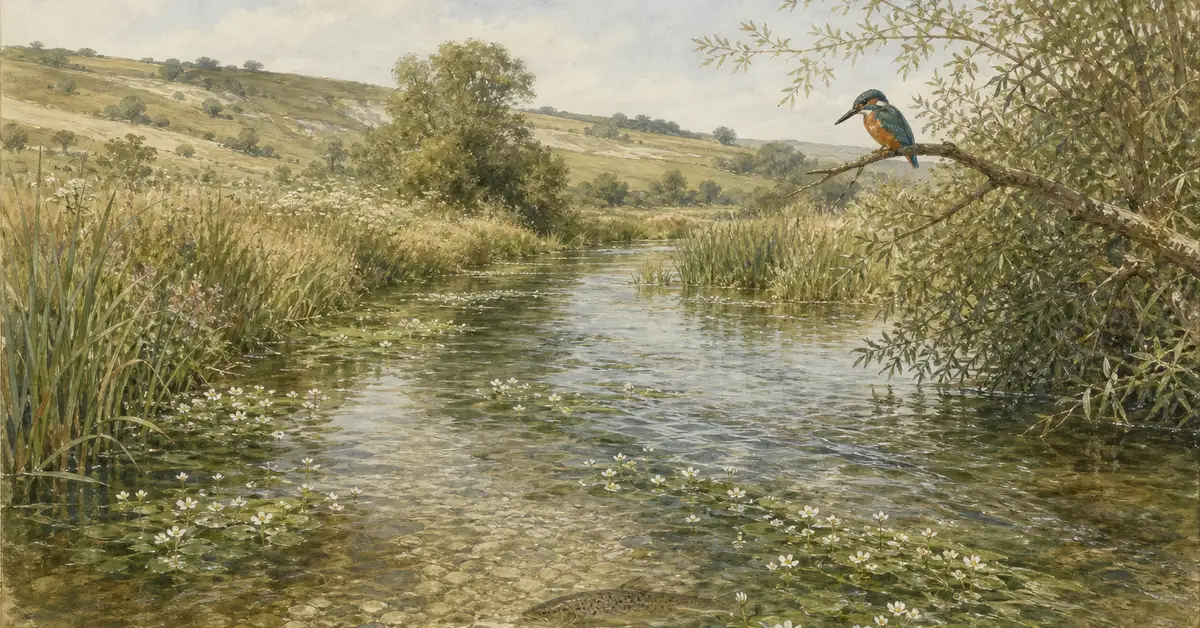
Biodiversity Hotspots in 2026: The Map Is Being Redrawn — A UK Reader's Guide to the 36 (and Counting)
A biodiversity hotspot is a region that holds at least 1,500 endemic vascular plant species and has lost 70% or more of its original primary vegetation. The 36 hotspots recognised by Conservation International cover just 2.5% of Earth's land surface but contain 50% of all endemic plants and 43% of endemic vertebrates. In October 2025, the IUCN began a two-year scientific revision of these boundaries — the first comprehensive update in over a decade.
That revision matters more than it sounds. Every "best biodiversity hotspots" explainer on the first page of Google still anchors on a count of 36 that may shift before 2027. This guide brings the framework up to 2026 with verified hard numbers, the latest 2025 deforestation data, the UK's funding and research role, and the five misconceptions still circulating in popular coverage.
36
Recognised Hotspots
Conservation International, 2026
~150,000
Endemic Plants
CI Hotspots Database, 2023
10,785
Endemic Vertebrates
CI Hotspots Database, 2023
10.5%
Original Habitat Remaining
CI Official Data, 2023
Sources: Conservation International, conservation.org/priorities/biodiversity-hotspots; Brummitt et al. 2021, One Earth.
Key Takeaway
Biodiversity hotspots are not just biodiverse regions — they are biodiverse regions under acute threat. Every officially designated hotspot has already lost most of its original habitat. The framework is a triage tool, not a celebration of richness.
What qualifies as a biodiversity hotspot?
To meet Conservation International's criteria, a region must satisfy two thresholds at once. First, it must contain at least 1,500 species of vascular plants found nowhere else on Earth — a level of endemism representing roughly 0.5% of the world's total plant diversity. Second, it must have lost 70% or more of its original primary vegetation, leaving 30% or less of the natural habitat that existed before significant human disturbance.
Vascular plants serve as the entry criterion because they are the best-documented major taxonomic group, taxonomically stable, and act as a reliable proxy for the wider ecological community. Where the plants concentrate, the insects, vertebrates, and fungi tend to follow. The habitat loss threshold is what makes the framework strategic rather than merely descriptive: a pristine, biodiverse area facing no immediate pressure does not qualify as a hotspot, regardless of its richness. The criteria explicitly target regions where conservation funding produces the highest return per pound spent — what conservation biologists call "complementarity prioritisation."
This stringency is the framework's strength. There are thousands of biodiverse places on Earth. There are 36 places that combine extraordinary uniqueness with proven, ongoing degradation. The mathematics of finite conservation funding makes those 36 the priority. Pixcellence's types of biodiversity guide explains how the species, genetic, and ecosystem layers interact within these regions.
The 36 hotspots in 2026: a regional snapshot
The 36 designated hotspots are spread across every inhabited continent, with strong concentrations in tropical and Mediterranean-climate zones. The table below summarises them by major realm. The regional totals overlap slightly because the Mediterranean Basin and Caucasus span Europe, Asia, and Africa.
| Region | Hotspots | Notable examples |
|---|---|---|
| Asia & Asia-Pacific | 13 | Indo-Burma, Sundaland, Wallacea, Western Ghats & Sri Lanka, Himalaya, Philippines, Japan, Forests of East Australia (35th, 2011) |
| Africa | 9 | Madagascar, Cape Floristic Region, Eastern Afromontane, Guinea Forests, Horn of Africa, Succulent Karoo |
| South America | 7 | Tropical Andes (most species-rich on Earth), Atlantic Forest, Cerrado, Tumbes-Chocó-Magdalena |
| North & Central America | 4 | California Floristic Province, Mesoamerica, Caribbean Islands, North American Coastal Plain (36th, 2016) |
| Europe & Central Asia | 3 | Caucasus, Irano-Anatolian, Mountains of Central Asia |
| Mediterranean & cross-realm | 1 | Mediterranean Basin (spans southern Europe, North Africa, Western Asia) |
Source: Conservation International official hotspot list, current to 2026.
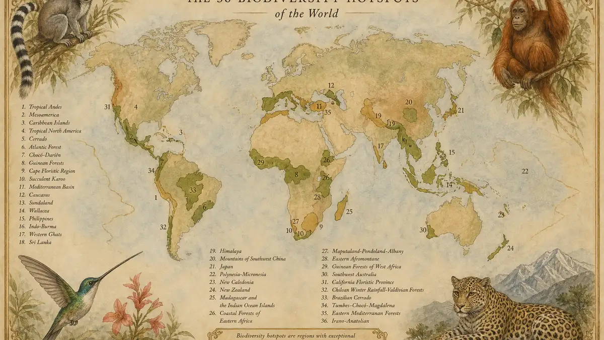
Within the 36, conservation scientists have informally identified the "eight hottest hotspots" — the regions where the combination of endemism and ongoing threat is most acute. These are the Tropical Andes, Mesoamerica, Caribbean Islands, Mediterranean Basin, Madagascar and the Indian Ocean Islands, Sundaland, Philippines, and Indo-Burma. The Tropical Andes alone contains roughly one-sixth of all terrestrial plant species; Sundaland holds more than 15,000 plant species, over 6,000 of them endemic.
Why the map is being redrawn (the 2025 IUCN update)
In October 2025, the International Union for Conservation of Nature announced a comprehensive scientific revision of the world's biodiversity hotspots project, funded by the Hempel Foundation and scheduled to run for approximately two years. This is the most significant update to the framework since the 35th and 36th hotspots were added in 2011 and 2016 respectively. The IUCN announcement made clear that the count, the boundaries, and the underlying endemism assessments are all open to revision.
Three pressures are driving the review. First, biodiversity datasets have improved dramatically since 2016 — remote sensing, eDNA sampling, and citizen-science platforms like iNaturalist now generate species records that simply did not exist a decade ago. Second, climate-driven range shifts mean species distributions are no longer where the original boundaries placed them. Third, ground-truthing in regions like the Eastern Afromontane and the Caucasus has revealed both new candidate hotspots and existing hotspots whose boundaries need adjusting.
What does this mean for someone reading a "biodiversity hotspots" article in 2026? The number 36 is correct now, but plan for it to change. Every legacy reference to a fixed list of 36 hotspots — including most of the top-ranked search results — risks becoming outdated mid-decade. For UK readers, photographers, and donors, this is also a quiet opportunity: the documentary value of currently-borderline ecosystems rises sharply if they are likely to be added to (or removed from) the next official list.
Origins: Norman Myers (1988) to the 2000 Nature paper

The biodiversity hotspot concept was introduced in 1988 by the British ecologist Norman Myers, in a paper titled "Threatened Biotas: 'Hot-Spots' in Tropical Forests," published in The Environmentalist, volume 8, issue 3. Myers identified ten tropical forest regions where extraordinary endemism overlapped with severe deforestation. The paper was modest in scale by today's standards, but its conceptual move — comparing regions by both irreplaceability and threat at once — reshaped how conservation funding flows globally.
The framework reached its modern form twelve years later. In February 2000, Myers and four collaborators published "Biodiversity hotspots for conservation priorities" in Nature, volume 403, pages 853–858. The full author byline, often miscited, is Norman Myers, Russell A. Mittermeier, Cristina G. Mittermeier, Gustavo A. B. da Fonseca, and Jennifer Kent — five authors, in that order. The 2000 paper formally extended the framework beyond tropical forests to Mediterranean ecosystems, montane cloud forests, and temperate rainforests, identifying 25 hotspots that became the operational basis for international conservation funding.
Conservation International took on the institutional role of maintaining the designation system, and in 1999 the Critical Ecosystem Partnership Fund (CEPF) was created jointly with the World Bank, Global Environment Facility, the Government of Japan, and Conservation International to channel money specifically into hotspot regions. CEPF enters its Phase IV implementation period (2026–2030) this year, with the explicit goal of moving from pilot projects toward longer-term, community-led interventions. Pixcellence's piece on biodiversity and conservation explores how this institutional architecture compares with other global frameworks.
Biological hotspot vs ecological hotspot: are they the same?
Several phrasings of this concept circulate in popular and academic writing, and they cause genuine confusion. "Biodiversity hotspot" is the formal Conservation International term and the canonical phrase. "Biological hotspot" is used interchangeably in some contexts, particularly older textbooks and non-specialist journalism, but it carries no formal definition of its own. "Ecological hotspot" is sometimes used to describe regions of high ecological activity or productivity — coral reefs, freshwater confluences, transition zones — that may or may not meet the strict endemism-plus-threat criteria. None of these synonyms changes the underlying CI framework. When in doubt, default to "biodiversity hotspot."
What's threatening hotspots in 2026
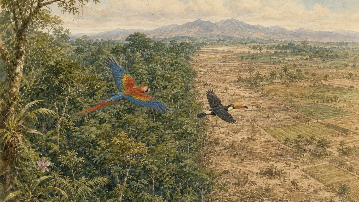
The 2025 forest-loss data from Global Forest Watch and the World Resources Institute tells a more nuanced story than the usual "everything is on fire" framing. Tropical primary forest loss in hotspot regions fell 36% from 2024 to 2025, following the record-breaking fire-driven losses of 2024. But absolute losses remain at 4.3 million hectares per year — 46% above the rate a decade ago, and equivalent to more than eleven football pitches every minute.
Within that headline number, the regional divergence is striking. Brazil cut primary forest loss by 42% across the Amazonia and Pantanal biomes between 2024 and 2025, attributed to strengthened federal enforcement, expanded protected areas, and improved monitoring. In the same window, Indonesia's primary forest loss rose 14%, driven by agricultural expansion and mining despite a permanent moratorium on new permits in primary forests and peatlands. In Peru's Madre de Dios region, within the Tropical Andes hotspot, gold mining alone accounted for 33% of primary forest loss between 2002 and 2025 — a single industrial activity reshaping a globally significant ecosystem.
Conservation Warning
The threat: The Mediterranean Basin hotspot is warming 20% faster than the global average, threatening endemic flora adapted to a winter-wet, summer-dry climate that is rapidly disappearing.
What this means: Endemic cypresses, pines, amphibians, and freshwater fish in the world's second-largest hotspot face range compression and habitat loss this decade — not in some distant future scenario.
Beyond forest cover, threats to hotspots include the wildlife trade — TRAFFIC's 25-year analysis of tiger seizures from 2000 to June 2025 documents consistent increases in whole-animal seizures across Indo-Burma and Sundaland. Climate-driven range shifts are compressing endemic species into ever-narrower elevation bands. Invasive species, particularly on island hotspots, continue to displace endemic flora. The picture is rarely catastrophic in isolation; it is the accumulation of pressures across decades that drives extinction. Pixcellence's deeper exploration of biodiversity loss walks through the cumulative dynamics.
What's working: indigenous-led conservation, KMGBF, restoration
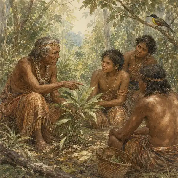
The most consequential finding in contemporary hotspot research is that 80% of global biodiversity is held in lands and waters conserved by indigenous peoples and local communities, despite those lands constituting a fraction of the world's formally designated protected areas. The Rights and Resources Initiative's 2025 Enabling Pathways report found that only 8% of formal protected areas (987 of 12,257) and 3% of Other Effective Area-Based Conservation Measures (7 of 227) are governed by indigenous peoples or local communities. Closing that governance gap is now treated as one of the highest-leverage conservation interventions available.
The Kunming-Montreal Global Biodiversity Framework, adopted at COP15 in December 2022, gave this work a formal scaffold through its 23 targets for 2030 — the best-known being the "30x30" commitment to protect 30% of land, inland waters, and seas. Target 5 specifically calls for indigenous and local community rights to be recognised in conservation, which has translated into legal reforms like Papua New Guinea's Protected Areas Act of 2024.
Active restoration is also producing evidence. A 2025 study in Oikos documented the recovery of frugivory networks (fruit-eating animals dispersing seeds) in Tijuca National Park, an urban Atlantic Forest fragment in Rio de Janeiro, 53 years after the original defaunation. After targeted reintroductions of locally extinct frugivores, ecological function began to return. The lesson is sobering and hopeful at once: restoration works, but the timescales are measured in human generations.
The UK's role: FCDO, CEPF, and the Cambridge research cluster
The United Kingdom does not contain a biodiversity hotspot. With around 1,500 native vascular plants in total — most of them not endemic — the UK falls well short of the 1,500 endemic threshold required for designation. Nor has the UK lost the requisite proportion of its original primary vegetation in the same way as designated hotspots. But UK funding, governance, and research capacity make it a meaningful international actor in the framework.
The Foreign, Commonwealth & Development Office's UK Small Island Developing States strategy 2026–2030 includes the Blue Belt Programme, which manages and protects approximately 4.4 million km² of ocean across small island developing states — many adjacent to terrestrial hotspots. Through the Green Climate Fund, US$2.2 billion has been approved for 78 biodiversity and climate projects in SIDS spanning 25 countries.
UK Funding Channels
FCDO Blue Belt (4.4M km² ocean), Green Climate Fund (US$2.2bn / 78 projects in SIDS), GEF and CEPF multilateral contributions, Defra UK Overseas Territories Biodiversity Strategy.
UK Research & NGO Cluster
Fauna & Flora International (Cambridge), BirdLife International (Cambridge), WWF-UK, RSPB, plus active hotspot research at Oxford, Cambridge, and University College London.
The Cambridge cluster matters disproportionately. Both Fauna & Flora International and BirdLife International — two of the most active hotspot conservation NGOs globally — are headquartered there, alongside the Cambridge Conservation Initiative on the same site. UK conservation expertise sits on CEPF's grant-making committees and technical panels, which means UK voices help shape funding allocation across hotspots from Madagascar to the Atlantic Forest. The relevant gap, identified in the research, is the Caucasus: UK engagement in this hotspot is limited despite its 1,600 endemic plants and significant European conservation responsibility. Pixcellence's UK biodiversity profile sets out where domestic and international conservation priorities intersect.
Help Us Document Wildlife Through the Lens of Conservation
Photographers documenting borderline hotspot ecosystems — places that may be added to or removed from the next official list — are creating records of unusual scientific value. We feature this work across Pixcellence's guides.
Five misconceptions still circulating in 2026
The hotspot framework has been in popular circulation for a quarter of a century, which is more than enough time for misunderstandings to ossify. Five recur often enough to be worth correcting.
"Hotspots are tropical only"
Five Mediterranean-climate regions, the California Floristic Province, the Caucasus, and the Mountains of Central Asia all qualify. The framework is climate-agnostic.
"More designations = better protection"
Designation requires habitat loss. A new hotspot on the list is a sign that a region has crossed the 70% loss threshold — bad news, not progress.
"Protection equals conservation"
The Biodiversa 2025 review confirmed that protected-area effectiveness depends on resourcing, enforcement, and community engagement. Paper parks deliver paper outcomes.
"Indigenous communities are obstacles"
Eighty percent of global biodiversity sits on indigenous and community-conserved lands. The evidence for community-led stewardship as a leading conservation strategy is now overwhelming.
"The 36 hotspots are fixed"
The IUCN/Hempel Foundation revision launched in October 2025 will redraw boundaries and may revise the count. Any reference to "36" carries an expiry date.
Frequently asked questions about biodiversity hotspots
How many biodiversity hotspots are there in the world?
There are 36 biodiversity hotspots officially recognised by Conservation International as of 2026. The 35th (Forests of East Australia) was added in 2011 and the 36th (North American Coastal Plain) in 2016. The IUCN began a comprehensive revision in October 2025 that may change this count by 2027.
Who came up with the concept of biodiversity hotspots?
The British ecologist Norman Myers introduced biodiversity hotspots in a 1988 paper, "Threatened Biotas: 'Hot-Spots' in Tropical Forests," published in The Environmentalist. The framework reached its modern form in a 2000 Nature paper by Myers, Russell Mittermeier, Cristina Mittermeier, Gustavo da Fonseca, and Jennifer Kent.
What are the two criteria for biodiversity hotspot status?
A region must contain at least 1,500 endemic vascular plant species and have lost 70% or more of its original primary vegetation. Both criteria must be met simultaneously — biodiverse regions without significant habitat loss do not qualify, and degraded regions without sufficient endemism do not qualify either.
What percentage of Earth's land surface do biodiversity hotspots cover?
The 36 hotspots collectively cover approximately 2.5% of Earth's terrestrial surface. Despite this small footprint, they contain 50% of the world's endemic plant species and 43% of endemic vertebrate species (mammals, birds, reptiles, and amphibians).
Is the United Kingdom a biodiversity hotspot?
No. The UK has roughly 1,500 native vascular plants in total, but very few are endemic, falling well short of the 1,500-endemic threshold. The UK does host populations of internationally important species, but it does not meet Conservation International's hotspot criteria.
What is the difference between a biodiversity hotspot and a Key Biodiversity Area?
Biodiversity hotspots are 36 large regions identified by Conservation International. Key Biodiversity Areas (KBAs) are individual sites of global biodiversity importance — there are over 9,000 KBAs worldwide. Hotspots and KBAs operate as a nested hierarchy, with KBAs identifying specific sites within and beyond hotspot regions.
Are there marine biodiversity hotspots?
Conservation International's 36-hotspot framework is terrestrial. Marine biodiversity hotspots have been identified separately by other research groups using comparable endemism-and-threat criteria, but they are not part of the official CI list. Coral Triangle and parts of the Mediterranean Sea feature prominently in marine hotspot literature.
What can individuals do to support biodiversity hotspot conservation?
Three actions have meaningful impact: support indigenous and community-led conservation organisations active in hotspots; reduce demand for commodities driving deforestation (palm oil, beef, soy without certification); and support UK-based hotspot funders such as Fauna & Flora International, BirdLife International, WWF-UK, and the RSPB, all of which channel funding into hotspot regions through the CEPF and other mechanisms.
Stay Connected with Conservation
Be the first to know about new guides, wildlife photography features, and conservation updates from across the UK and beyond.
Sources: Conservation International; IUCN biodiversity hotspots update (October 2025); Kunming-Montreal Global Biodiversity Framework; WRI Global Forest Review 2025; TRAFFIC 25-year tiger seizure analysis; UK SIDS Strategy 2026–2030; Myers, N., Mittermeier, R. A., Mittermeier, C. G., da Fonseca, G. A. B. & Kent, J. (2000). Biodiversity hotspots for conservation priorities. Nature, 403, 853–858. doi.org/10.1038/35002501.