Key Takeaway
Every development in England must now deliver a measurable 10 per cent increase in biodiversity using the Statutory Biodiversity Metric. The metric converts habitat area, ecological quality and location into standardised units — calculated separately for area habitats, hedgerows and watercourses — and gains must be secured for a minimum of 30 years. Getting the calculation right is the difference between planning approval and refusal.
10%
Mandatory Net Gain
Minimum uplift required
3
Unit Types
Area, hedgerow, watercourse
30 yrs
Legal Security
Minimum habitat commitment
July 2025
Statutory Metric
Current legal standard
Sources: Environment Act 2021, Defra Statutory Biodiversity Metric User Guide July 2025
In This Article
- What Is the BNG Metric?
- How Biodiversity Units Are Calculated
- Baseline Habitat Assessment
- The Trading Rules
- The Small Sites Metric
- Worked Calculation Example
- Common Mistakes and Quality Assurance
- What Is Changing in 2026
What Is the BNG Metric?
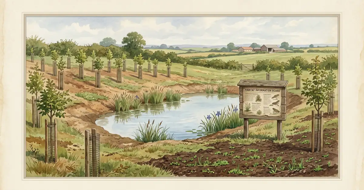
Biodiversity Net Gain (BNG) is a legal requirement under the Environment Act 2021 that obliges developers in England to leave wildlife habitats in a measurably better state than before development. The mandatory minimum is a 10 per cent increase in biodiversity value, measured using the Statutory Biodiversity Metric published by Defra and Natural England. BNG became mandatory for major developments from February 2024 and for small sites from April 2024.
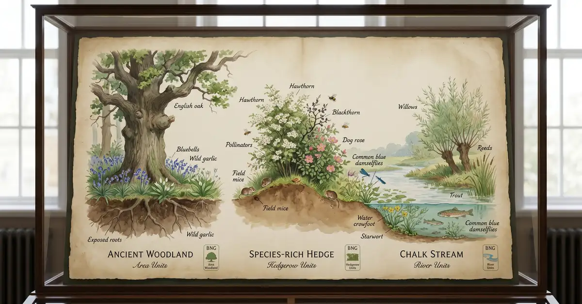
The Statutory Biodiversity Metric (SBM), published in its current form in July 2025, is the only legally valid tool for calculating compliance. Earlier advisory versions — including Biodiversity Metric 3.0 and 4.0 — are no longer accepted by local planning authorities. The metric operates across three independent modules: area habitat units (for woodlands, grasslands, wetlands and other spatial habitats), hedgerow units (for linear hedgerow features and lines of trees) and watercourse units (for rivers, streams, canals and ditches). Each module must independently achieve the 10 per cent uplift — gains in one category cannot compensate for losses in another.
Before any metric calculation begins, the mitigation hierarchy applies: avoid impacts first, then minimise, then restore on-site, and only offset elsewhere as a last resort. Local planning authorities expect developers to demonstrate they have followed this hierarchy before approving a Biodiversity Gain Plan.
How Biodiversity Units Are Calculated
The metric converts ecological information into standardised biodiversity units using a formula that integrates five variables. For area habitats, the calculation is:
Biodiversity Units = Area (ha) × Distinctiveness × Condition × Strategic Significance × Temporal Risk
Each variable acts as a multiplier. Distinctiveness reflects the rarity and ecological importance of a habitat type, scored on a five-point scale from very low (e.g. cereal crops) to very high (e.g. blanket bog, lowland fens). These scores are fixed by habitat type in the metric and cannot be adjusted based on individual site conditions.
Condition represents the ecological health of each habitat parcel — assessed against published criterion sheets as poor, moderate or good. A hectare of woodland in good condition with diverse age structure and abundant deadwood generates more units than the same woodland type in poor condition with invasive species and browsing pressure.
Strategic significance reflects whether habitats sit within areas identified as conservation priorities. The government is reforming this multiplier to align with Local Nature Recovery Strategies (LNRS), incentivising habitat creation in locations that contribute to landscape-scale nature recovery.
Temporal risk multipliers account for the time newly created habitats need to reach target condition. Newly planted woodland might take 30 years or more to reach good condition, so it generates fewer units in year one than established woodland of the same type. This prevents developers from claiming full value for habitats that exist only on paper.
| Distinctiveness | Example Habitats | Trading Rule |
|---|---|---|
| Very High | Blanket bog, lowland fens, limestone pavement | Must replace with same type (often irreplaceable) |
| High | Lowland mixed deciduous woodland, heathland, reed beds | Must replace with same habitat type |
| Medium | Semi-improved grassland, lowland acid grassland, mixed scrub | Same broad habitat group or any higher distinctiveness |
| Low | Modified grassland, cereal crops, ruderal vegetation | Any habitat of equal or higher distinctiveness |
| Very Low | Sealed surfaces, highly degraded land | Trading rules not typically applicable |
Source: Defra Statutory Biodiversity Metric User Guide July 2025, Lichfields Guide to the BNG Trading Rules
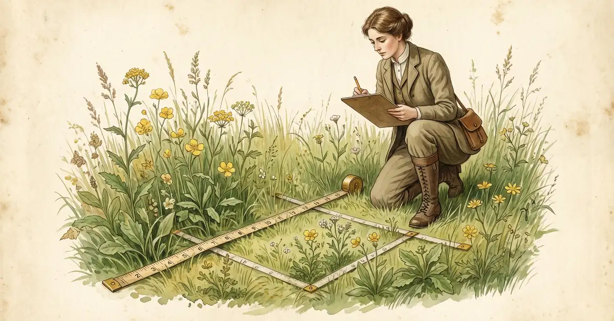
Baseline Habitat Assessment
Every BNG calculation starts with a baseline habitat survey — the ecological snapshot against which post-development improvements are measured. Habitats must be classified using the UK Habitat Classification (UKHab) system, version 2.0, which provides a standardised taxonomy from broad categories (grassland, woodland, wetland) down to specific types (lowland calcareous grassland, lowland mixed deciduous woodland). No other classification system is accepted.
The survey process involves dividing a site into discrete habitat parcels, classifying each under UKHab, assessing condition against published criterion sheets, and mapping strategic significance. For major developments, surveys must be conducted by competent ecologists with formal qualifications and demonstrated BNG experience. For Small Sites Metric applications, the competent person requirement is more flexible — they need not be a qualified ecologist but must demonstrate relevant knowledge and experience.
Condition assessment follows structured protocols for each habitat type. For example, ditch condition examines water clarity, flow, plant diversity, silt build-up and bank erosion against eight criteria. Meeting all eight criteria indicates good condition; six or seven indicates moderate; five or fewer indicates poor. Every assessment must be supported by evidence — site photographs, species records and field notes — not professional guesswork.
The Trading Rules
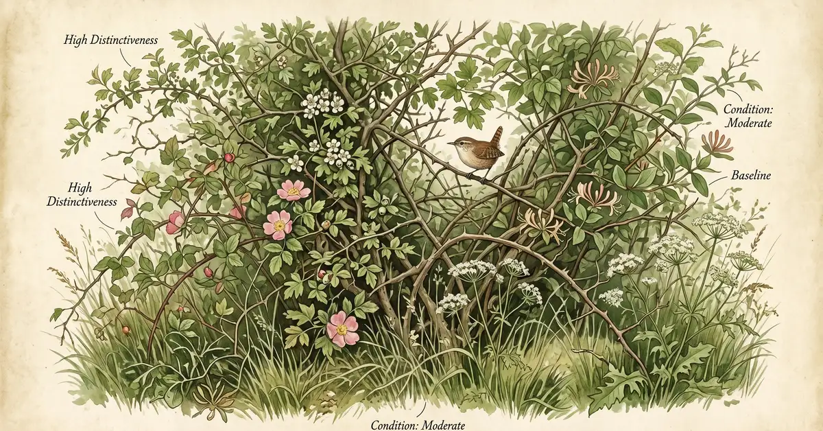
The trading rules are among the most important and misunderstood elements of the BNG framework. They enforce a principle of like-for-like or better habitat replacement, preventing developers from clearing ecologically valuable habitats and compensating with common ones.
What You Cannot Do
Clear a hectare of lowland calcareous grassland (high distinctiveness) and compensate by planting modified grassland (low distinctiveness) elsewhere. Clear all hedgerows and offset by creating abundant area habitat. Use gains in one unit type to cover shortfalls in another.
What You Can Do
Replace low distinctiveness habitat loss with medium or high distinctiveness habitat of any broad type. Replace medium distinctiveness losses with medium habitats in the same broad group or higher. Enhance retained habitats from poor to good condition to generate additional units.
Irreplaceable habitats — including ancient woodland, ancient and veteran trees, blanket bog and limestone pavements — sit outside the standard BNG calculation entirely. Development impacts on irreplaceable habitats trigger bespoke planning tests rather than simple unit calculations, and their loss is extremely difficult to justify.
The Small Sites Metric
The Small Sites Metric (SSM) provides a streamlined calculation pathway for minor developments. It uses the same three habitat unit modules and the same 10 per cent net gain requirement as the full Statutory Biodiversity Metric, but with simplified condition assessment protocols. Intermediate categories such as "fairly good" and "fairly poor" are typically not used, reducing the documentation burden for smaller projects.
Only one metric tool should be used per application — either the SSM or the full metric, not both. Some applicants have attempted hybrid approaches, using the SSM for some habitats and the full metric for others, but planning authorities reject these. Trading rules, the 30-year legal security requirement and the three independent unit-type calculations remain identical to the full metric.
Worked Calculation Example
Consider a simplified three-hectare development site with mixed habitats. The baseline survey identifies 1.5 hectares of modified grassland (low distinctiveness, poor condition), one hectare of lowland mixed deciduous woodland (high distinctiveness, moderate condition), 300 metres of hedgerow (medium distinctiveness, moderate condition) and a 200-metre ditch in poor condition.
Calculate Baseline Units
Apply the formula to each habitat parcel. The modified grassland (1.5 ha × low distinctiveness × poor condition) generates relatively few units. The woodland (1.0 ha × high distinctiveness × moderate condition) generates substantially more. Hedgerow and watercourse units are calculated separately using length rather than area.
Assess Development Impact
Map which habitats will be lost (housing footprint), retained (amenity space, buffer zones) or enhanced (improved management). In this example, 0.8 ha of grassland and 0.5 ha of woodland are lost to construction. The remaining grassland is converted to wildflower meadow and the retained woodland is enhanced through invasive species removal.
Calculate Post-Development Units
Newly created habitats are penalised by temporal risk multipliers — a new woodland might only generate 40 per cent of the units that an established woodland would. Enhanced retained habitats contribute more units than they did at baseline. The post-development total must reach at least 110 per cent of baseline across each unit type.
Address Any Shortfall
If on-site provision falls short of 10 per cent net gain, the developer must secure off-site habitat bank units or, as a last resort, purchase statutory biodiversity credits from the government. Off-site habitats must be registered on Natural England's Biodiversity Gain Sites Register and secured for 30 years.
Common Mistakes and Quality Assurance
Since mandatory implementation in early 2024, clear patterns of error have emerged in BNG applications across England. Understanding these pitfalls is essential for anyone preparing or reviewing assessments.
Six Errors That Get BNG Applications Rejected
1. Over-optimistic condition scoring — assigning "good" condition to habitats that fail key criteria, inflating baseline units and masking the true net gain requirement.
2. Habitat misclassification — calling modified grassland "lowland meadow" without supporting species data, which artificially raises distinctiveness scores.
3. Ignoring temporal risk — assuming newly planted habitat generates mature-condition units from year one, dramatically overstating post-development value.
4. Trading rule violations — attempting to compensate for high distinctiveness habitat loss with low distinctiveness habitat creation.
5. Missing unit types — calculating area habitat units but omitting hedgerow or watercourse units despite their presence on site.
6. Spatial risk errors — misapplying distance-based multipliers for off-site habitat, particularly as the system transitions to LNRS-aligned zones.
Best practice involves independent quality assurance by senior ecologists not involved in the original assessment. This includes verifying UKHab classifications, cross-checking condition assessments against photographic evidence, recalculating a sample of metric outputs manually, and confirming that all three unit types meet the 10 per cent threshold independently. Some local planning authorities now employ specialist BNG officers to review submissions, while others contract external ecology consultancies for independent validation.
What Is Changing in 2026
In December 2025, Defra confirmed a significant package of reforms scheduled to take effect before 31 July 2026. These represent the first major revision to BNG policy since mandatory implementation.
| Reform | What It Means | Timeline |
|---|---|---|
| 0.2 ha exemption | Sites under 0.2 hectares exempt from BNG (removes 50%+ of smallest applications) | Before 31 July 2026 |
| Self-build exemption removed | Self-build and custom-build projects over 0.2 ha now subject to BNG | Before 31 July 2026 |
| Temporary permissions | Development with temporary permission (max 5 years) exempt from BNG | Before 31 July 2026 |
| Spatial risk reform | Multipliers shift from LPA-based zones to LNRS-aligned priority areas | Guidance expected 2026 |
| NSIPs included | Nationally Significant Infrastructure Projects subject to 10% BNG for the first time | 2 November 2026 |
Sources: Defra Government Response December 2025, Pinsent Masons NSIP Analysis
The government is also consulting on potential BNG exemptions for residential brownfield development, recognising that open mosaic habitat on previously developed land can make the 10 per cent target difficult to achieve on small brownfield sites — creating a perverse incentive against building on land that planning policy otherwise prioritises for housing.
Oxford University research published in 2025 has raised broader questions about whether the habitat-based metric adequately captures actual biodiversity outcomes, particularly in urban and agricultural contexts where common habitats may support substantial invertebrate and bird diversity despite low metric distinctiveness scores. Future metric refinements may address these concerns, though any changes will require consultation and transition periods.
Frequently Asked Questions
What is the Statutory Biodiversity Metric and how does it work?
The Statutory Biodiversity Metric (SBM), published by Defra in July 2025, is the only legally valid tool for calculating biodiversity net gain in England. It measures biodiversity value using the formula: Biodiversity Units = Area (hectares) × Distinctiveness × Condition × Strategic Significance × Temporal Risk. The metric operates across three independent modules — area habitat units, hedgerow units and watercourse units — each of which must separately achieve the mandatory 10 per cent net gain.
How is the 10 per cent biodiversity net gain calculated?
Developers must survey baseline habitats using the UK Habitat Classification (UKHab) system, assess each habitat parcel for distinctiveness, condition and strategic significance, then input this data into the Defra Statutory Biodiversity Metric calculator. The tool produces baseline biodiversity units. Post-development habitat plans must generate at least 110 per cent of baseline units across all three unit types independently.
What are the BNG trading rules?
Trading rules enforce like-for-like or better habitat replacement. High distinctiveness habitats lost must be replaced with the same habitat type. Medium distinctiveness losses can be replaced with medium habitats in the same broad group or any higher distinctiveness habitat. Low distinctiveness losses can be replaced with any habitat of equal or higher distinctiveness. Irreplaceable habitats such as ancient woodland cannot be calculated within the standard BNG framework.
What is the Small Sites Metric for BNG?
The Small Sites Metric (SSM) is a simplified version of the Statutory Biodiversity Metric for minor developments. It uses the same three habitat unit modules and 10 per cent requirement but with streamlined condition assessment protocols. Intermediate categories like "fairly good" are not used. Only one metric tool should be used per application — either the SSM or the full metric.
What changes are coming to BNG rules in 2026?
Major reforms confirmed by Defra include a new exemption for sites under 0.2 hectares, removal of the self-build exemption, exemption for temporary planning permissions of up to five years, reform of spatial risk multipliers to align with Local Nature Recovery Strategies, and extension of BNG to Nationally Significant Infrastructure Projects from 2 November 2026.
How long must BNG habitat gains be maintained?
All gains must be legally secured for a minimum of 30 years through either a Section 106 agreement with the local planning authority or a conservation covenant with a designated responsible body. These agreements bind current and future landowners and require a detailed Habitat Management and Monitoring Plan.
Further Reading
- Biodiversity Net Gain: The Complete Guide
- BNG Regulations and Exemptions
- Biodiversity and Conservation: The UK Guide
- Biodiversity Action Plans
- What Are Ecosystem Services?
- Payments for Ecosystem Services
Sources: Defra Statutory Biodiversity Metric User Guide July 2025, Defra Small Sites Metric User Guide July 2025, Defra Government Response December 2025, RSPB BNG Toolkit, Oxford University BNG Research 2025, Lichfields Trading Rules Guide